In August 1975, Helsinki found itself in the global spotlight. Leaders from 35 countries gathered in Finland’s capital to sign the Helsinki Final Act, a landmark agreement in the Cold War era that helped lay the groundwork for dialogue between East and West. It was one of Finland’s most significant diplomatic moments, launching what would become the Organization for Security and Co-operation in Europe (OSCE).
Fifty years later, Finland again welcomes representatives from across the OSCE region to mark the anniversary. While the political landscape has shifted in countless ways, the values agreed upon in 1975 around cooperation and human rights remain deeply relevant today. The 2025 commemorative events reflect on those ideals and their enduring role in European security and diplomacy.
To honour the moment, we’re stepping into a visual time machine. These ten sets of photographs pair archival images from 1975 with new ones taken in the exact same locations this year. Some scenes are nearly unrecognisable; others appear untouched. Together, they tell the half-century story of urban transformation in Helsinki.
1. Porthaninkatu and Toinen linja, Kallio
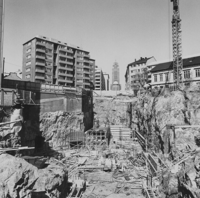
Photo: unknown/Helsinki City Museum
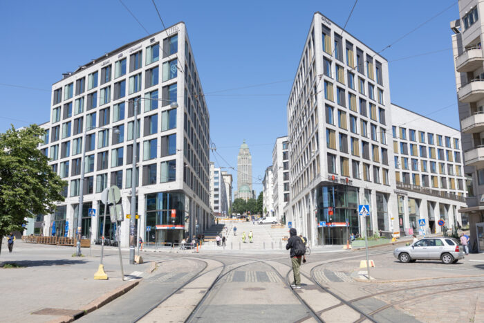
Photo: Emilia Kangasluoma
Construction at this busy Kallio corner foreshadowed the city’s underground future in 1975. The underground structures, like many in the network, were built to serve a dual purpose: metro transit and civil defence, functioning as bomb shelters if needed. Above ground, Kallio has transformed over five decades: from a working-class district into a more expensive and trendy neighbourhood.
2. Tervasaari shoreline
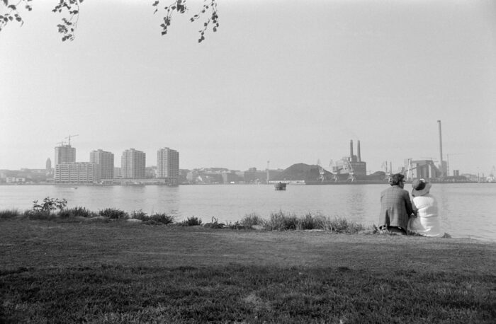
Photo: Eeva Rista/Helsinki City Museum
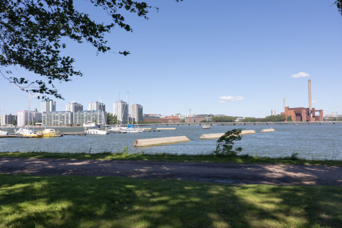
Photo: Emilia Kangasluoma
A couple sits beside the water in 1975, with coal piles and the Hanasaari power plant behind them. Today, the view is cleaner and greener: Helsinki Energy (Helen) stopped using coal in Hanasaari in 2023, marking a major step toward a carbon-neutral city.
3. Hakaniementori
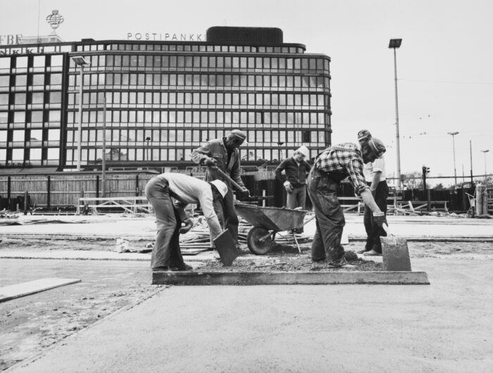
Photo: unknown/Helsinki City Museum
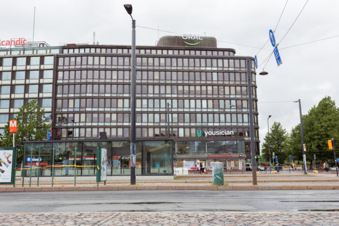
Photo: Emilia Kangasluoma
In 1975, the site at Hakaniementori was a bustling construction zone, part of Helsinki’s first metro digging works. The metro opened in 1982 with 17 stations and has since expanded to 30, stretching from Kivenlahti in the west to Mellunmäki and Vuosaari in the east.
4. Köydenpunojankatu and Kalevankatu, Kamppi
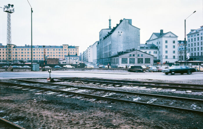
Photo: unknown/Helsinki City Museum
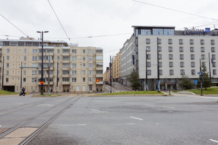
Photo: Emilia Kangasluoma
In the 1975 photo, the Valio building on Kalevankatu marks the spot where Nobel Prize–winning chemist Artturi Ilmari Virtanen once worked on groundbreaking food preservation methods. The location is now a hotel, and the surrounding area has been completely transformed. Kamppi’s harbour tracks have vanished, making way for a mix of housing, offices and cultural spaces.
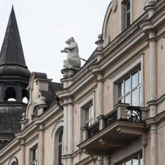
5. Mariankatu, Kruununhaka
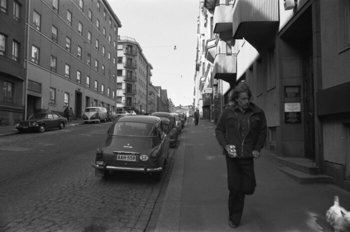
Photo: Eeva Rista/Helsinki City Museum
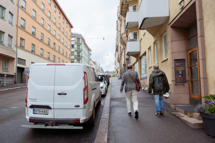
Photo: Emilia Kangasluoma
This quiet stretch of Mariankatu still looks much the same as it did in the 1970s, with rows of historic buildings and a calm, residential feel. While cobblestones have been replaced with pavement, the overall atmosphere of Kruununhaka remains steady, more lived-in than polished, and slightly out of step with the pace of the city centre just a few blocks away. It’s a part of Helsinki where change happens slowly, if at all.
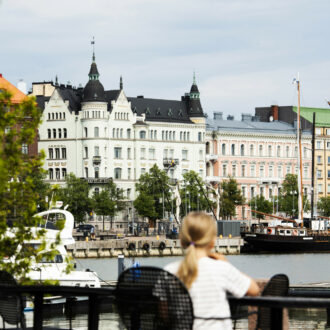
6. Pohjoisranta, looking toward Katajanokka
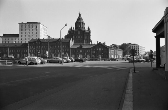
Photo: Eeva Rista/Helsinki City Museum
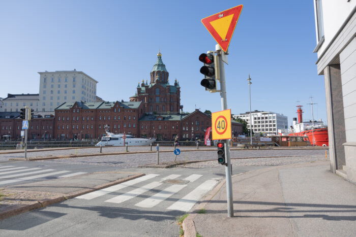
Photo: Emilia Kangasluoma
In 1975, parked cars lined the waterfront as Pohjoisranta served as a key route for traffic heading out of the city centre. Today, a bike path runs where the cars once stood, part of Helsinki’s broader transformation into a more cycling- and pedestrian-friendly city. Across the water, Uspenski Cathedral and the red-brick warehouses of Katajanokka remain a distinctive part of the skyline.
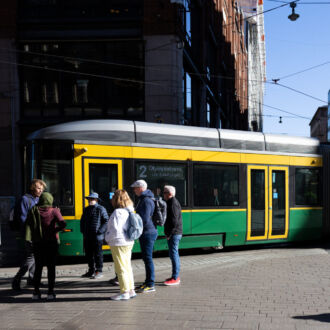
7. Kaisaniemenkatu near Rautatientori
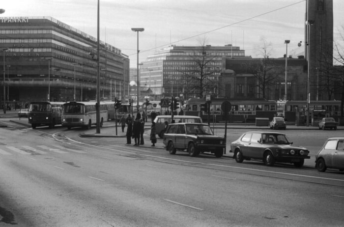
Photo: Eeva Rista/Helsinki City Museum
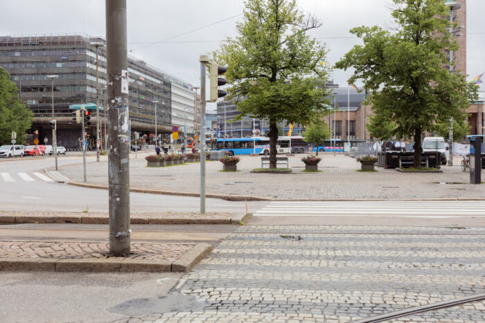
Photo: Emilia Kangasluoma
Buses crowded Kaisaniemenkatu in 1975, the road thrumming with traffic and serving as a central conduit just outside Helsinki’s main station. The left-most building, constructed in 1967, was nicknamed Makkaratalo (the “Sausage House”) for the cylindrical concrete cantilever around the facade. During major renovations in 2005, there was an opportunity to remove the “sausage,” but it was instead marked for preservation due to its architectural and historical value. Originally designed with car ramps and rooftop parking, the building reflected a time when Helsinki was planning for a car-oriented future. Today, the ramps are gone, and the area has shifted toward wider sidewalks, bike lanes and pedestrian space.
8. Merihaka from Siltavuorenranta
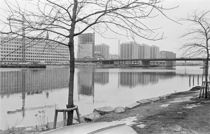
Photo: Patrick Oras/Helsinki City Museum
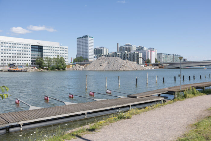
Photo: Emilia Kangasluoma
Merihaka’s striking concrete towers rise in this 1970s view, part of a distinctive housing project that stood apart from most of Helsinki’s more traditional neighbourhoods. Today, a new bridge has replaced the old one, with a tram line under construction along the shoreline to better link Merihaka with the rest of the city. The trail here is also a recent addition, part of a 15-kilometre loop that traces the city’s inner coastline.
9. Mannerheimintie, Kamppi
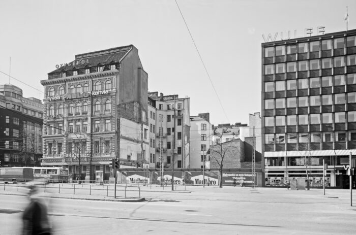
Photo: Kari Hakli/Helsinki City Museum
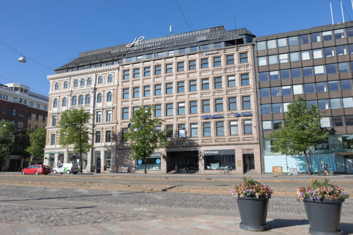
Photo: Emilia Kangasluoma
In 1975, this lot at the corner of Mannerheimintie and Bulevardi sat empty after a previous building had been demolished. Like many parts of central Helsinki in the postwar decades, the area was in transition, shaped by shifting plans for development. Today, it houses a modern office building and sits at a key junction between the city centre and Kamppi.
10. Finlandia Hall from Töölönlahti
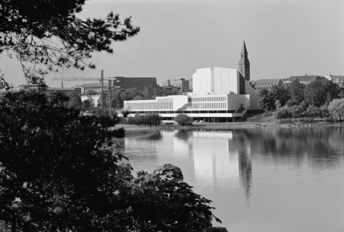
Photo: Volker von Bonin/Helsinki City Museum
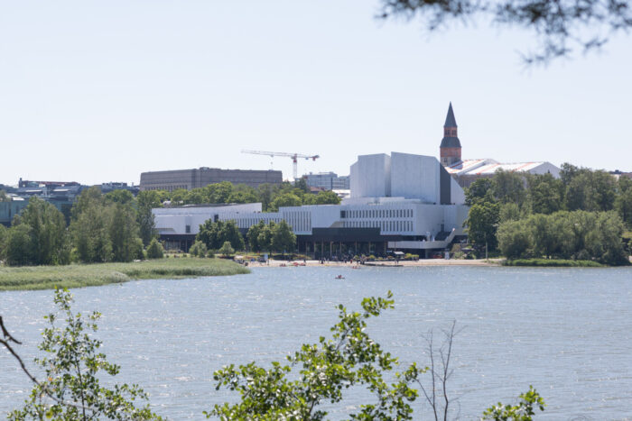
Photo: Emilia Kangasluoma
This view across Töölönlahti toward Finlandia Hall places us near the very heart of the OSCE story. Designed by Alvar Aalto, the white marble building hosted the historic summit in 1975 and continues to host major events today.
As Finland commemorates the 50th anniversary of the OSCE, Helsinki offers both a physical and symbolic backdrop: a place where diplomacy was once signed into history, and where everyday life continues to evolve.
Text by Tyler Walton, July 2025